Herinnering verbeelding toekomst
- Location
Strijp S - Date
2007-10-31


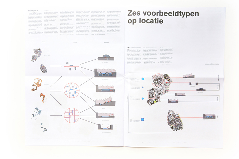
Location De Lutte, Municipality of Losser

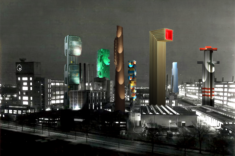
Industrial buildings with villas on top

Farmyards

Sport and cultural amenities

The new village periphery of De Lutte

Office park

Patio dwellings

Terraced apartments
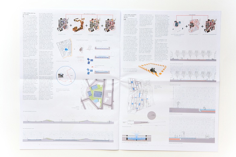
For motorists who cross the border between the Netherlands and Germany via the A1 motorway De Lutte is either the first or the last village on Dutch soil. The A1 provides excellent access to De Lutte via the connection to Oldenzaal, but is also causes a great deal of noise nuisance. In addition, it also restricts the village's growth potential. The motorway and the secondary road run close by the village and a sort of buffer zone has developed, part of which is formed by a noise barrier. In the rest of this zone, actually the village periphery, there are a number of old and new business locations which, to put it mildly, contribute little to the village's identity. Because De Lutte faces away from the infrastructure it also turns its back on the attractive, gently-sloping ash landscape encircling the village. It is precisely in this nuisance zone, however, where the opportunities for meshing with the landscape lie.
Our proposal is to completely surround De Lutte, to all intents and purposes, with an earthen wall accommodating functions that are normally disproportionate to the scale of the village, but are of economic importance. The way in which this is achieved varies and is dependent on the function itself and the location. In the new, green village periphery this creates space for offices, logistics businesses, intensive cattle breeding, but also for pile-supported housing. The wall guarantees the peace and intimacy of the village and, from the top, it provides a view of both the village and the surrounding landscape.
The walling-in also addresses another assignment in De Lutte: namely the connection between the existing village and the Luttermolenveld, a neighbouring park with holiday homes. Now that permanent residence has recently been permitted here, both halves of the village should also be conceptually interlinked. This new village periphery frames both halves of the village and is crowned by a pedestrian route where long-established villagers and newcomers can take a stroll and meet each other.
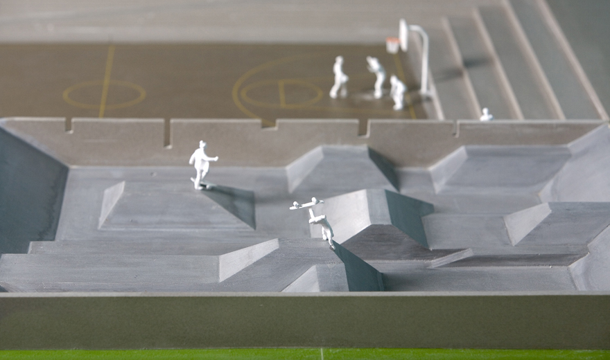
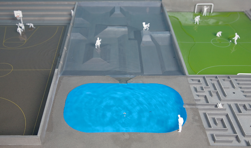
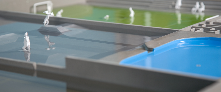
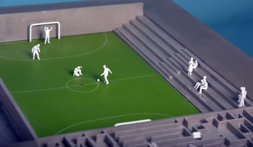
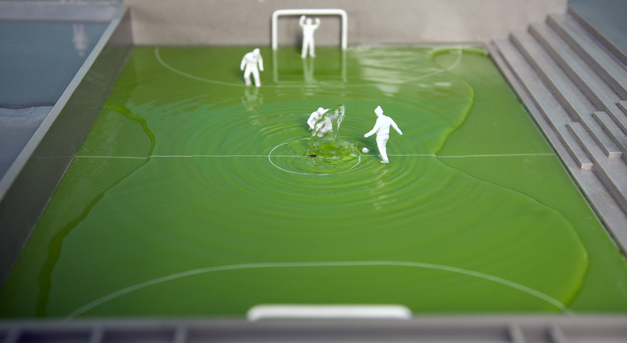
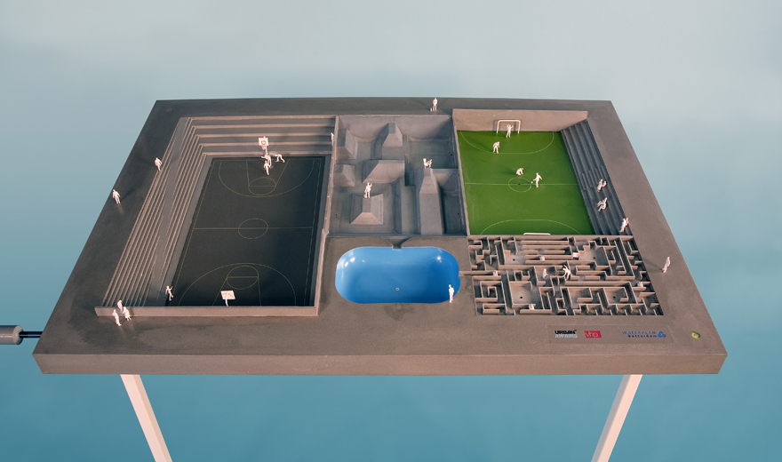
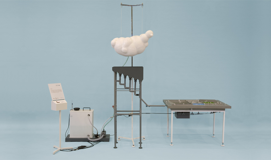
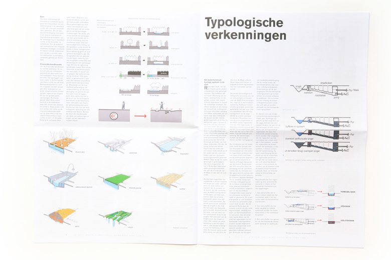
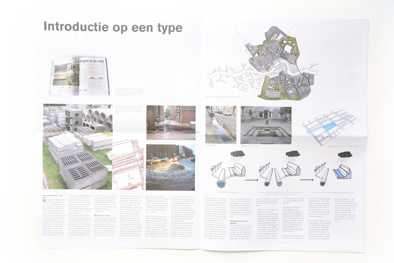
Climate change means that more space is required for water. In the Netherlands this requires innovatory measures. In the near future it will rain more frequently and more heavily, water squares are the solution for this problem. A water square is dry for the greater part of the time and it is then used as a public area in an urban context. After a heavy downpour, the form and the use of the water square are transformed. The elements that are necessary for water storage are deployed, wherever possible, to create an attractive recreational area.
A water square focuses on the optimum use of the available budget for solving the water issue. The money is not spent on expanding the underground sewerage system but on above-ground solutions. This has various advantages:
* The expenditure on the water issue is visible. Moreover, this issue addresses another question, that of the lay-out of the public space. This is seen as problematical in many areas of Rotterdam. Laying out an area as a public space and, at the same time, for the collection of water, has financial advantages. There are, as it were, opportunities for budgetary double usage.
* Water squares make the water issue and its solution visible and tangible in the daily cityscape. Because of this they make a direct contribution to the spatial profile for a water city and, with that, to the appeal and the distinctive character of a city.
* Water squares contribute to more sustainable water management. The water collection system need not be tackled in one go, it can be achieved on a small scale and step-by-step. It is a phaseable solution for the sustainable upgrading of the entire water system.
* Making the water issue visible in the public space also has an educational objective. Climate change that is accompanied by the threat of flooding receives little public attention because it is simply not in the public eye. The city dweller has lost contact with natural systems such as water management. Living with water is an ongoing task, not only in terms of awareness but also as an urban and socio-cultural ritual: water connects.
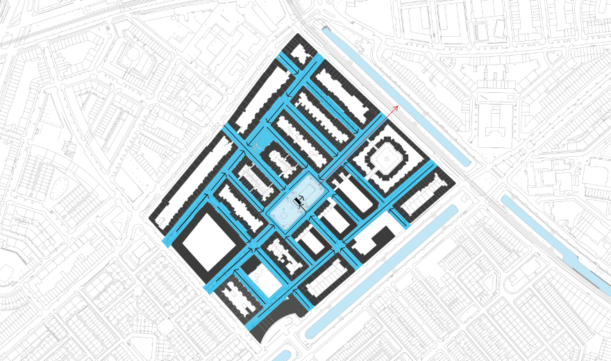
Catchment area water regime and optimum use of the Bloemenhofplein
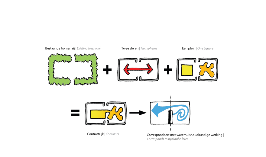
Square design principles
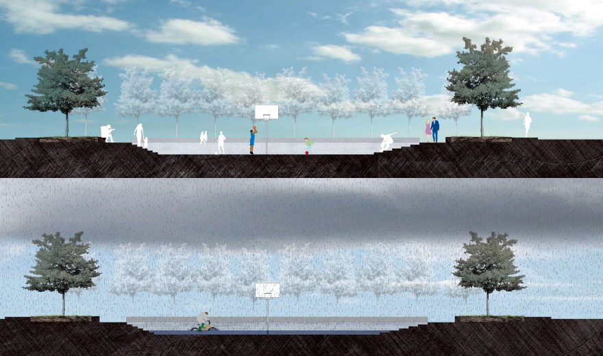
Section at nice weather sport field | Section after a heavy rain shower: a temporary layer op water on the square
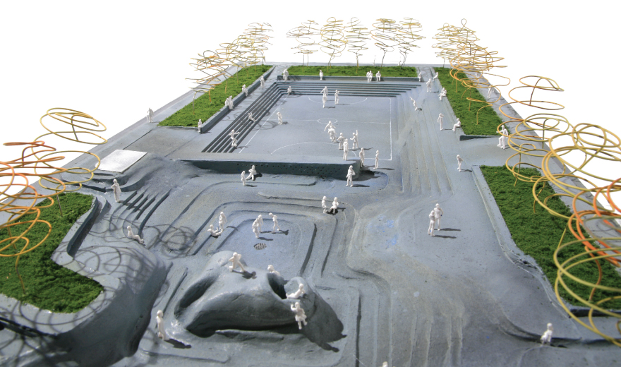
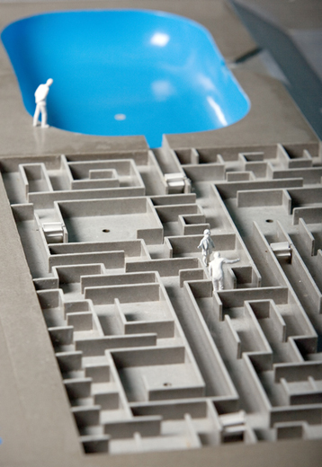
Model
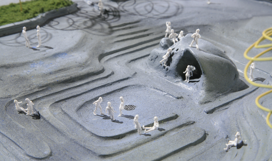
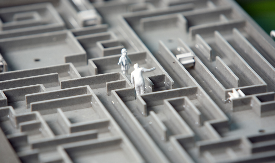
Detail model
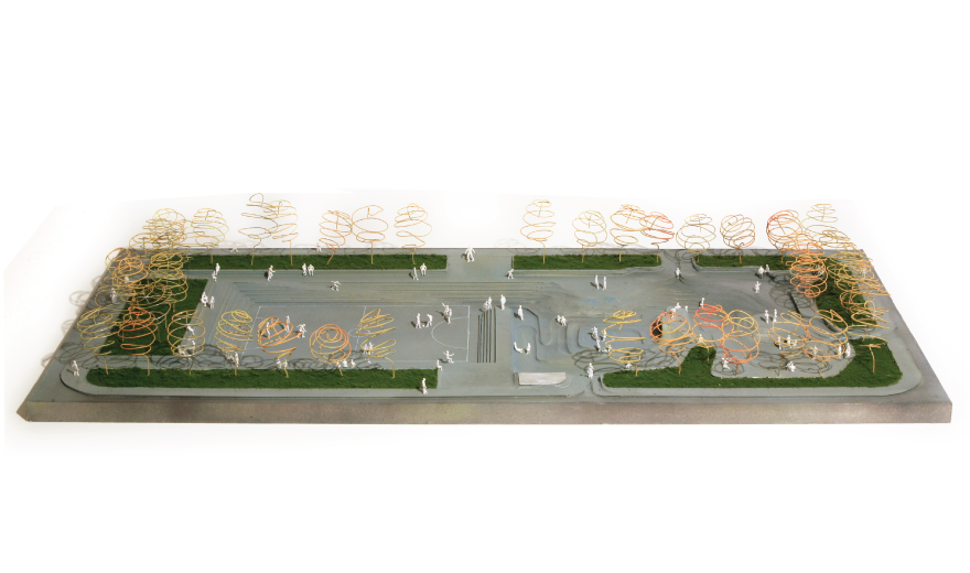
Model
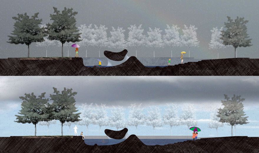
Section at the beginning of a peak rain shower: splash in a low layer of water | Section after a heavy rain shower: a temporary pond
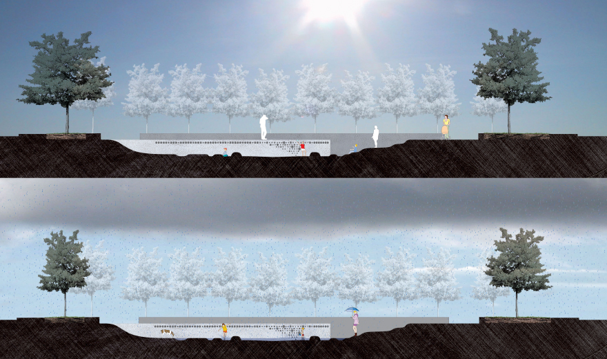
Section in sunny weather: play on an the bumpy landscape | Section after a heavy rainstorm: a fountain sprays, a layer of water makes little trench and routes for boats
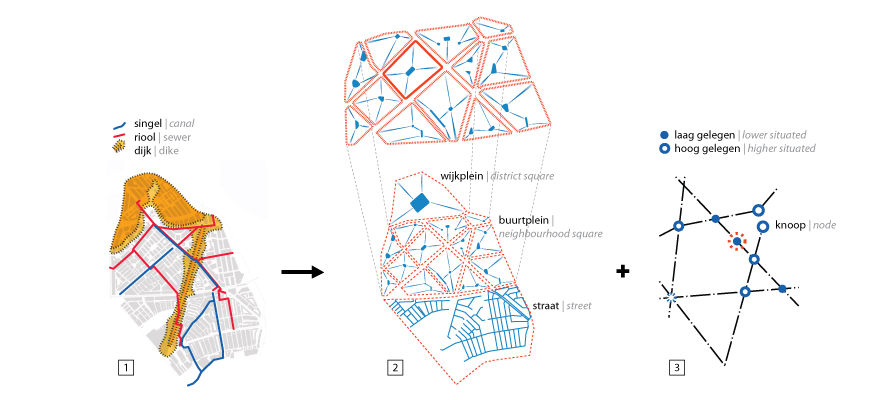
Strategy for the Oud Zuid district in Rotterdam | 1. Facts Hydrologic regime | 2. Storage above-ground with spatial scheme of the districts and neighborhoods | 3. Storage under-ground with above-ground structures
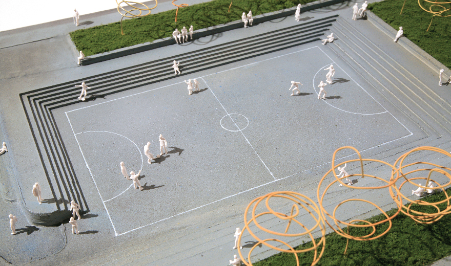
Detail model
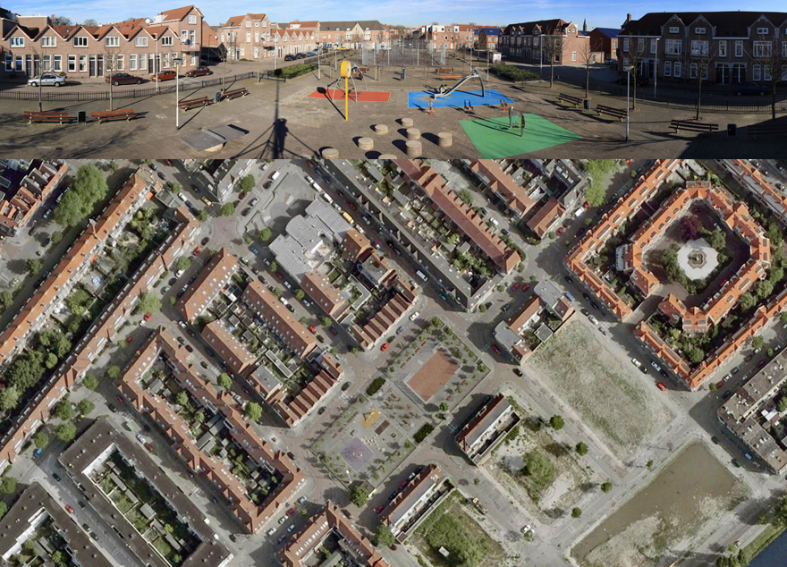
Location Bloemenhofplein
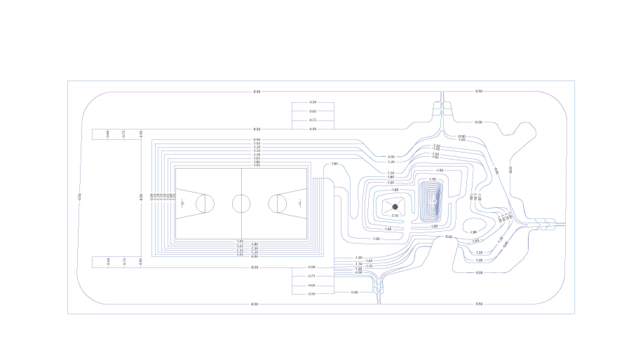
Height map square
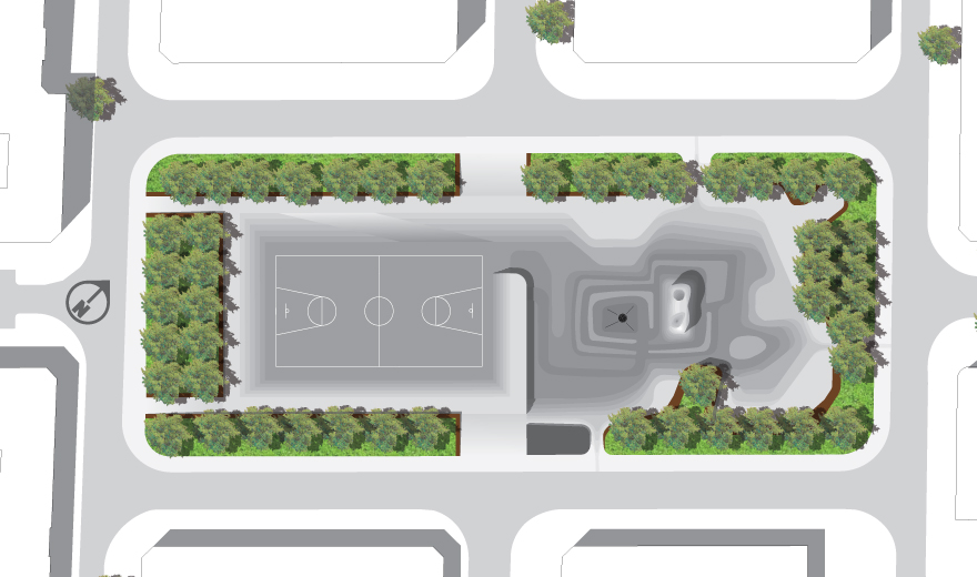
Map square
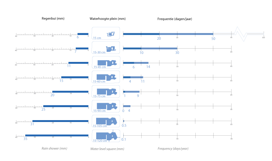
How often is how much water on the square?

Impressions of the square in fine weather, after a rain shower and during a heavy rainstorm
In the Oud Zuid district there is a serious flooding issue and this requires a comprehensive and complete strategy for the future. We have developed diverse water management solutions for various spatial structures in this urban district. One of these solutions is a range of sunken neighbourhood squares. These water squares offer a solution for the local flooding that can be executed step by step in each neighbourhood.
Bloemhofplein is a textbook example of a central neighbourhood square within a traditional urban layout and is eminently suitable as a central water square. The water storage volume of the square is limited, but still substantial (approximately 950 m2) and this means that the surrounding streets can drain directly into the square. Because the groundwater level is reasonably high, measures will have to be taken to keep the sunken part of the square dry. This can probably be achieved by means of drains that can also be used to discharge the rainwater into the open water in the canals.
The urban situation and the water management in the northern part of Oud Zuid have many points in common with each other. The Bloemhofplein approach can serve as an example for the many comparable squares in this urban district, whereby the significance of the pilot transcends the physical impact. Bloemhofplein is presently a multi-functional square and, as a water square, it will also appeal to a diverse group of people who will use it to sit, exercise, play games or simply spend leisure time there. The new water square will become a representative, central space in the neighbourhood.
 Subscribe to RSS